Home of Arizona Brevets and Long Distance Cycling
|
Jerome, AZ REGISTRATION:
Registration is closed. |
| Mingus Mountain 200k |
||||||||||||||||||||||||||||||||||||||||||||||||||||
Date: Saturday, May 16, 2015
Distance: 125 miles Start Time: 06:00 (6 am) Time Limit: 13.5 hours Sunrise: 4:55 amSunset: 7:52 pm Moonrise: 4:28 am Moonset: 6:01 pm Cost: $30 ACP sanctioned. WAIVER NOTE: You will be automatically directed to the online waiver after you submit your PayPal payment. If you are not automatically directed to the online waiver after your pay, you may press the "Return to Merchant" button to sign the waiver. The online waiver may also be found at tinyurl.com/AZBrevetWaiver. REGISTRATION NOTE: Once you are registered for a ride, you will see your name in the Registered Riders tab. It may take a day or so for it to appear. Registered riders WILL be sent a "Last Minute Notes" email the day after registration closes, normally the Thursday before the ride. If you do not receive it, please let me know. Also, check your spam folder for the email. RIDE VERIFICATION: All of these events
are sanctioned by Randonneurs USA (RUSA).
As such, all of them will be verified using approved RUSA
methods. Click HERE
to see the details of available options for AZ Radonneurs'
events. Description
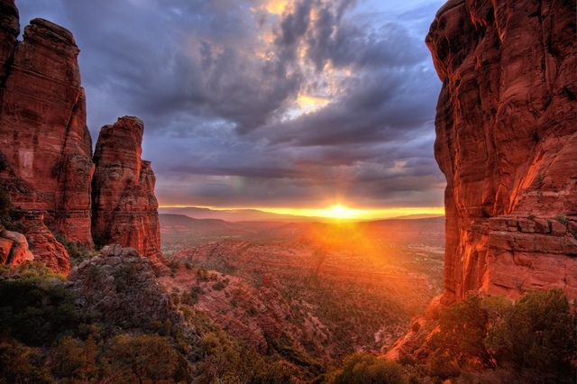
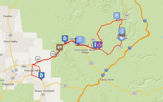
Sunset Over Sedona Dramatic Sedona Red Rocks to forested Mingus Mountain summit over and back via scenic roads. 125mi/200km~9000 ft climbing (85% RWGPS). Directions to the start Location: Bashas Grocery: Sedona, AZ Address: 160 Coffee Pot Drive; Sedona, AZ Directions: Google map: Click hereFrom Phoenix: I-17 to Exit 298 onto AZ-179 N to Sedona, AZ
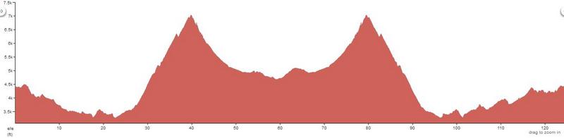
Cue sheets may be downloaded and printed by riders if they wish. Cue sheets will NOT be passed out at the start. Make sure you have a cue sheet as a backup in case your GPS fails. (PDF format is not yet available.) Elevation Profile Total 9,000 ft of climbing
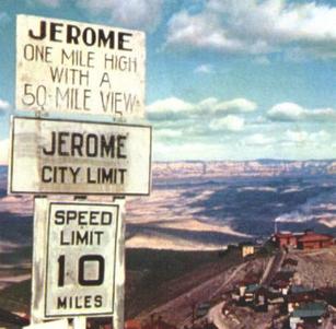
Requirements Required reflective wear – jacket/vest/ankle bands/SamBrowne belt, head+tail lights; Recommended helmet light, cell phone, repairs kit (bike shops in Sedona, Cottonwood, Oak Creek Village on or near route) Services Services are available at regular intervals. Scenic road sections are well paved but without shoulders. Dramatic climb and descents on the Mingus Mtn Scenic Road – ride with awareness and caution in these sections. Well-maintained brakes necessary for mountain switchback descents out and back. Much of the route is posted with “Share the Road” signs and include good designated shoulders/bike lanes in the non-mountain sections. Plenty of motels near ride start/finish and also (less expensive) in nearby Village of Oak Creek or just south in Cottonwood. 12 Registered Riders.
|