Home of Arizona Brevets and Long Distance Cycling
|
Saguaro Lake Marina REGISTRATION:
Registration is closed or not yet open. |
| Saguaro Lake 200k |
||||||||||||||||||||||||||||
Date: Saturday, January 17, 2026
Distance: 126 miles Start Time: 07:30 Time Limit: 13.5 hours Sunrise: 7:30 amSunset: 5:47 pm Cost: $15 Pre-registration only. No day-of-event registration. ACP sanctioned. WAIVER NOTE: You will be automatically directed to the online waiver after you submit your PayPal payment. If you are not automatically directed to the online waiver after your pay, you may press the "Return to Merchant" button to sign the waiver. The online waiver may also be found at tinyurl.com/AZBrevetWaiver. REGISTRATION NOTE: Once you are registered for a ride, you will see your name in the Registered Riders tab. It may take a day or so for it to appear. Registered riders WILL be sent a "Last Minute Notes" email the day after registration closes, normally the Thursday before the ride. If you do not receive it, please let me know. Also, check your spam folder for the email. RIDE VERIFICATION: All of these events
are sanctioned by Randonneurs USA (RUSA).
As such, all of them will be verified using approved RUSA
methods. Click HERE
to see the details of available options for AZ Radonneurs'
events. Description
Saguaro Lake 200k
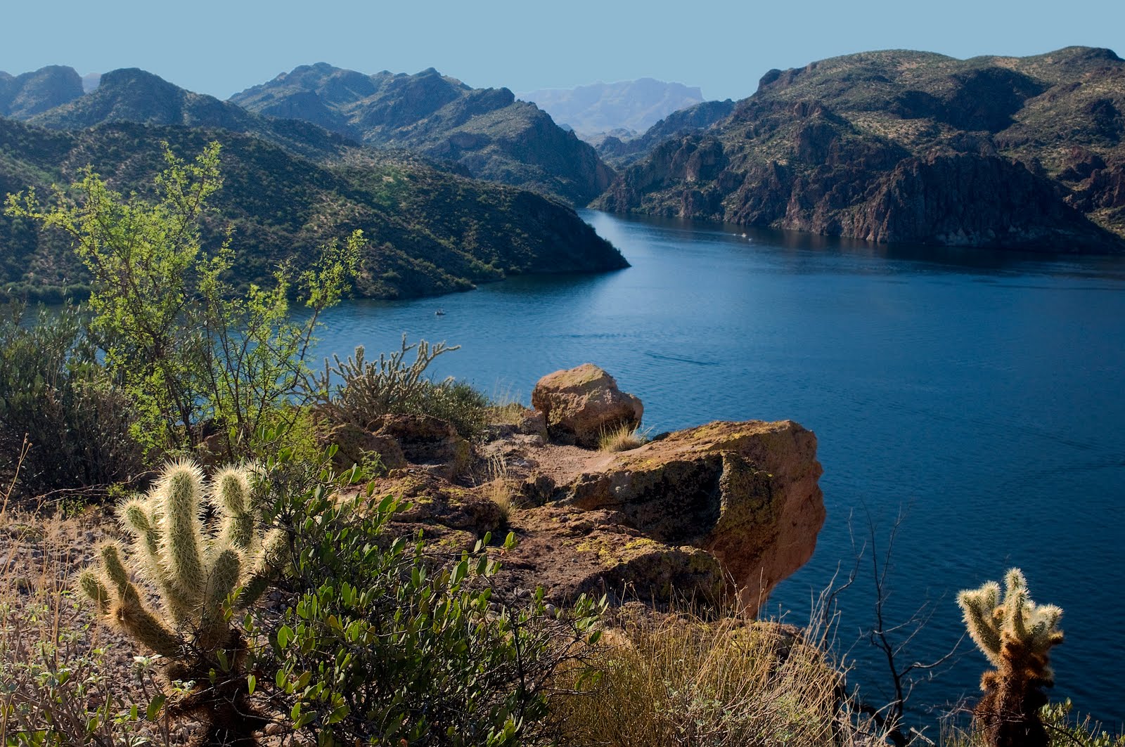
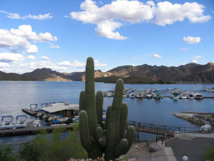
Saguaro Lake looking up the canyon to the Salt River. Directions to the start Location: Fountain Hills Blvd, Fountain Hills, AZ Address: Intersection at Palasades and Fountain Hills Blvd Google map: Click here
Route Map
View RWGPS online map here 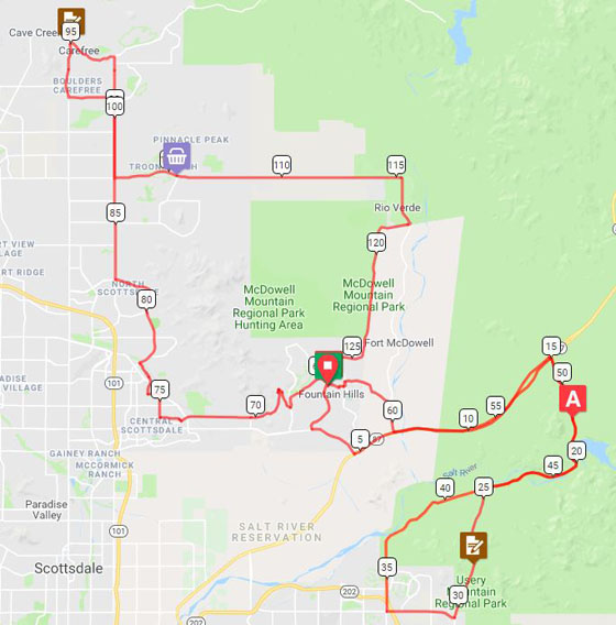 Cue sheets may be downloaded and printed by riders if they wish. Cue sheets will NOT be passed out at the start. Make sure you have a cue sheet as a backup in case your GPS fails. (Excel sheet is not available.) Elevation Profile
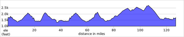
Total climbing is about 6800 ft., depending on which measurement device you use.
Requirements Riders are expected to do simple repairs such as repair a flat tire. Lights, safety vest/belt, and ankle bands are required if riding after sunset. Note that there is only about 10 hours of light for this ride since sunset is at 17:30. You should plan to have lights and reflective equipment with you at all times.
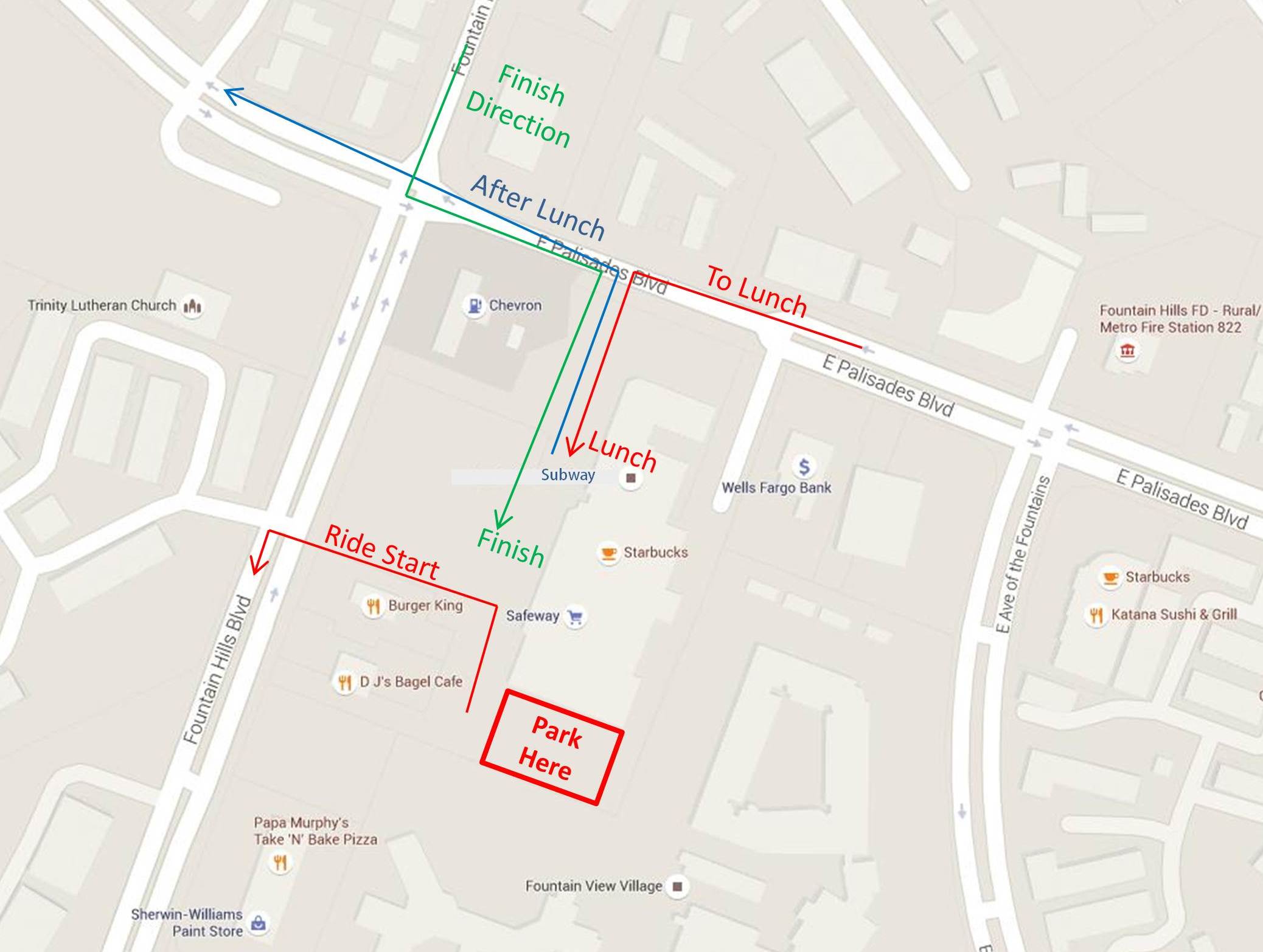
Services The Start/Finish will be located in Fountain Hills, AZ. A Google map may be found here. Here is a detailed map of the Start/Lunch/Finish. It can be confusing because we enter/leave the plaza from different directions and meet at different places at different times. 1) START: Park behind the Pizza Hut. We will meet there for the ride start 2) LUNCH: Will be at Subway or any other establishment in the plaza, your choice. 3) FINISH: Will be any service in the plaza. Click Image for a High-Rez View Checkpoint #2 is at the top of the second climb (Usery Pass). This may be a staffed control with some snacks and water. If not, you will need to answer the question on your brevet card, or use any other authorized method of verification. Checkpoint #3 will be back at the Start/Finish location. This will be your "lunch" stop. You will also be back at your car if you want to shed clothes or pick up more supplies for the next 100k loop Checkpoint #4 will be located in Cave Creek at the Shell station / Grocery store. This is a bicycle-friendly location and is accustomed to seeing a lot of cyclists. Water/Food at mile ~105 will be your last supply opportunity on the route and at the top of the 5th, and final, climb! This convenience store will not be staffed and is not a required stop. After this convenience store, you get to enjoy "9 mile hill." This will be a nine mile descent followed by a very picturesque ride past McDowell Mountain Park and back to Fountain Hills. Keep your eyes open as you approach Fountain Hills. The fountain goes off every half hour and can be seen from the route. Checkpoint #5 is in Fountain Hills and is the finish! Get a receipt from any biz in the plaza if you're using that type of proof. 6 Registered Riders.
|