Home of Arizona Brevets and Long Distance Cycling
|
Sunrise over Saguaro National Park East REGISTRATION:
Registration is closed or not yet open. |

| Just North of the Border |
||||||||||||||||||||||||||||
Date: Saturday, March 25, 2023
Distance: 250 miles Start Time: 06:00 Time Limit: 27 hours Sunrise: 6:26 amSunset: 6:43 pm Cost: $40 Pre-registration only. No day-of-event registration. ACP sanctioned. WAIVER NOTE: You will be automatically directed to the online waiver after you submit your PayPal payment. If you are not automatically directed to the online waiver after your pay, you may press the "Return to Merchant" button to sign the waiver. The online waiver may also be found at tinyurl.com/AZBrevetWaiver. REGISTRATION NOTE: Once you are registered for a ride, you will see your name in the Registered Riders tab. It may take a day or so for it to appear. Registered riders WILL be sent a "Last Minute Notes" email the day after registration closes, normally the Thursday before the ride. If you do not receive it, please let me know. Also, check your spam folder for the email. RIDE VERIFICATION: All of these events
are sanctioned by Randonneurs USA (RUSA).
As such, all of them will be verified using approved RUSA
methods. Click HERE
to see the details of available options for AZ Radonneurs'
events. Description
NOTE: This route enters Saguaro National Park. There will be a rider FEE set by the NPS. If you have a National Park Pass, it will be accepted for free entrance. Up to 4 riders may enter with each NP Pass presented.
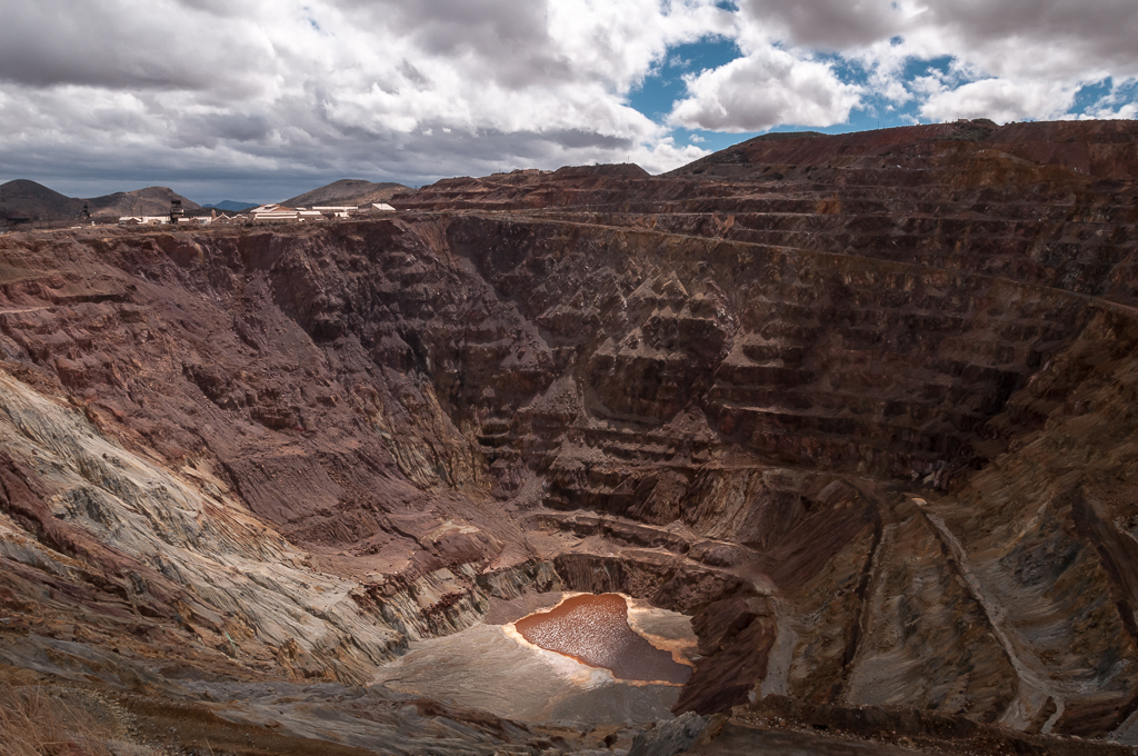
Lavender Pit in Queen Mine. Bisbee AZ. Directions to the start Location: El Con Plaza Starbucks in Tucson Address: Starbucks at: 3421 E Broadway Blvd #191, Tucson, AZ 85716 Click here for a map to the start. Directions: East on Broadway Rd ~4 miles from I-10There is plenty of parking near Starbucks/Walmart/etc.
Route Map
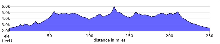
View RWGPS online map here  Cue sheets may be downloaded and printed by riders if they wish. Cue sheets will NOT be passed out at the start. Make sure you have a cue sheet as a backup in case your GPS fails. Elevation Profile
Requirements Lights, safety vest/belt, and ankle bands are required when riding before sunrise and after sunset. Note that there is only about 12 hours of daylight for this ride so a good set of lights will be required. Services Start: Starbucks/Walmart – The start/finish control is in the El Con Plaza on E Broadway Rd in Tucson.
There are multiple services in the area. Starbucks opens at 05:00 but closes at 10 pm. If riders finish after 10 pm, there is an alternate control location at a 24 hour Circle K noted on the route sheet.
6 Registered Riders.
|