Home of Arizona Brevets and Long Distance Cycling
|
Where you're heading! REGISTRATION:
Registration is closed or not yet open. |

| Desert 100 |
||||||||||||||||||||||||||||
Date: Saturday, October 24, 2020
Distance: 63 miles Start Time: 06:00 Time Limit: 6.75 hours Sunrise: 6:40 AMSunset: 5:44 PM Moonrise: 2:34 p.m. Moonset: 12:09 a.m. Cost: $1 All riders must pre-register. (No day of event registration.) RUSA sanctioned. WAIVER NOTE: You will be automatically directed to the online waiver after you submit your PayPal payment. If you are not automatically directed to the online waiver after your pay, you may press the "Return to Merchant" button to sign the waiver. The online waiver may also be found at tinyurl.com/AZBrevetWaiver. REGISTRATION NOTE: Once you are registered for a ride, you will see your name in the Registered Riders tab. It may take a day or so for it to appear. Registered riders WILL be sent a "Last Minute Notes" email the day after registration closes, normally the Thursday before the ride. If you do not receive it, please let me know. Also, check your spam folder for the email. RIDE VERIFICATION: All of these events
are sanctioned by Randonneurs USA (RUSA).
As such, all of them will be verified using approved RUSA
methods. Click HERE
to see the details of available options for AZ Radonneurs'
events. Description
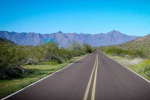
Climbing South Mountain Desert 100 Description The Desert 100 brevet route is noticeably different than the other routes running concurrently. This route actually has a climb! And, not just any old climb. Riders will start on the same route as the other distances, but will diverge pretty quickly from them, at mile 24. After the split, riders will make their way to the base of South Mountain where you will climb Summit Rd to the top. You'll have some spectacular views of the Valley below as you stand at the elevation of the TV towers. After you take your obligatory photos, you'll get to experience the super fun descent. You'll want to use some caution because the smooth pavement will allow you to gain more speed than your Guardian Angel can keep up with. Once at the bottom, you will ride some bike paths and other low traffic roads as you make your way back to the finish. Services are located at regular intervals along the route. Terrain: Mostly flat, except for one big ol' hill in the middle! Directions to the start Location: Start Location is at I-10 & Chandler Blvd in Chandler Address: This address is outside the Denny's. See map. Click here for a Google map to the ride start location.
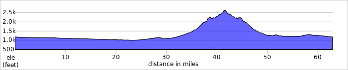
Cue sheets may be downloaded and printed by riders if they wish. Cue sheets will NOT be passed out at the start. Make sure you have a cue sheet as a backup in case your GPS fails. Elevation Profile
~2250 feet of climbing. Requirements Lights, reflective vest, ankle bands are not Required. Services Services are spaced at regular intervals and are noted on the cue sheet and in the GPS file. 6 Registered Riders.
|